Story 03

Comprehensive Flood Control in Neyagawa Basin
From Flood-Stricken to Flood-Resilient with
Comprehensive Flood Control Measures
Outline
In recent years, torrential cloud bursts have frequently resulted in flood damage across Japan. Today, traditional flood control measures alone are often not enough. Now, the various stakeholders across the entire river basin, including river administrators, sewer administrators and local public entities, must work together on basin-wide comprehensive flood control to reduce flood damage throughout the basin. Located in east Osaka Prefecture, the Neyagawa basin was one of the first in Japan to tackle such comprehensive flood controls. Back in 1984, a Neyagawa Basin Committee was established by the national government, Osaka Prefecture, and 11 municipalities in the basin, which has long battled flooding. The committee promoted river and sewer system improvements, and advanced water control measures were commenced to artificially restore water retention and storage functions in the basin. NEWJEC's River Engineering Group has walked alongside the committee through this comprehensive flood control work for more than 40 years.
Member
-
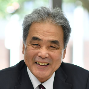 Ken Saito
River Division
Ken Saito
River Division
River Engineering Group Saito has been engaged in comprehensive flood control in the Neyagawa basin for nearly 40 years, since 1984. As the long-time administrative engineer, he has worked in overall management for the project. -
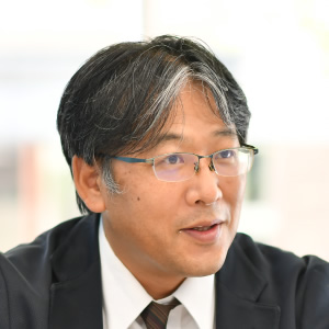 Naoya Masuda
River Division
Naoya Masuda
River Division
River Engineering Group Established the rules for regulating sewage pump operation. Along with Saito, Masuda currently works in overall management of the project as an administrative engineer.
Chapter 1
Comprehensive flood control, integrating river and sewer system
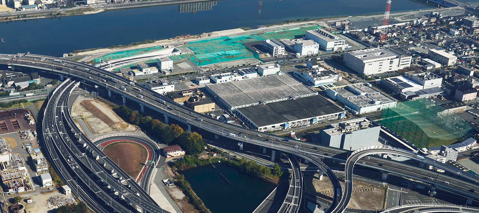
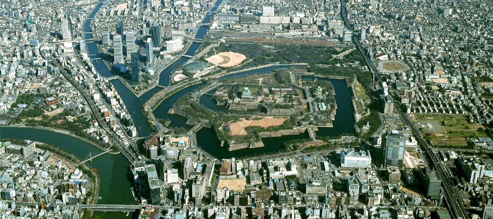
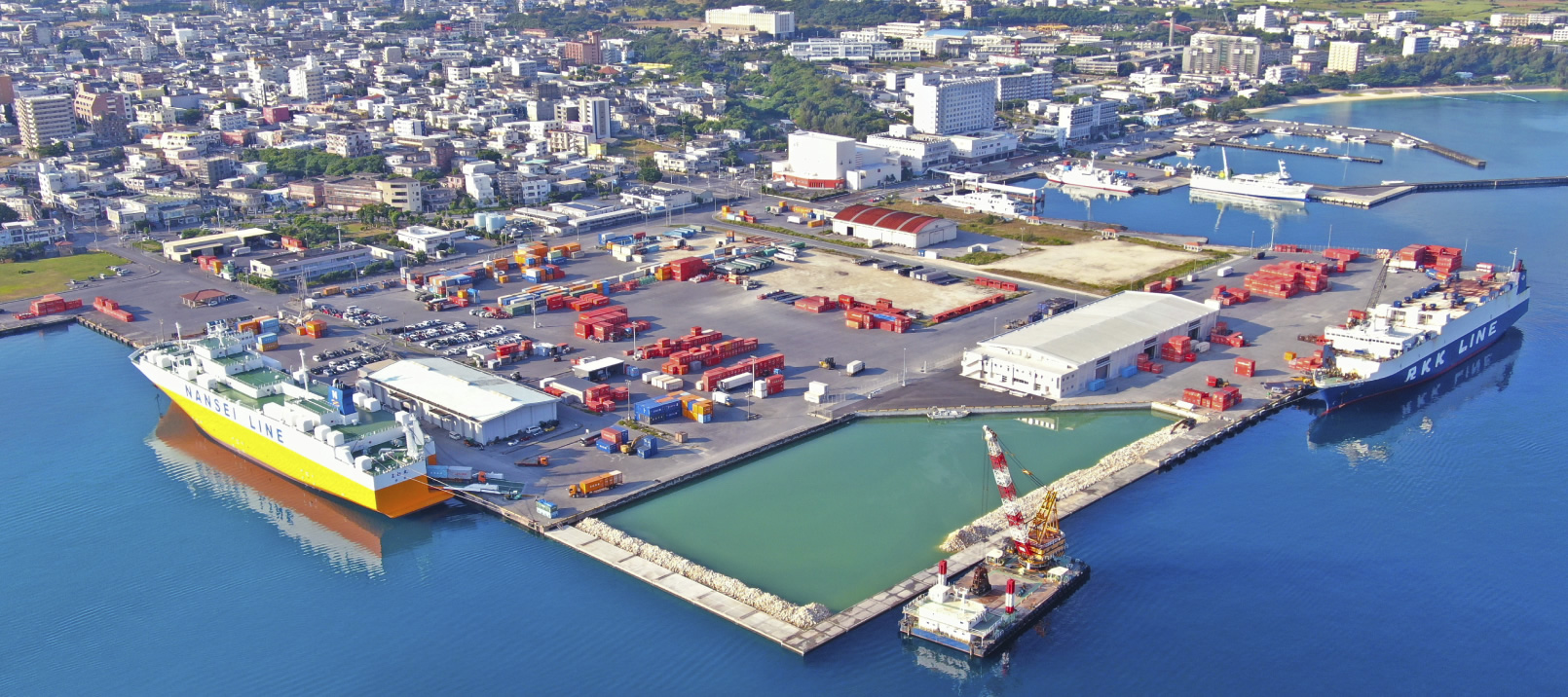
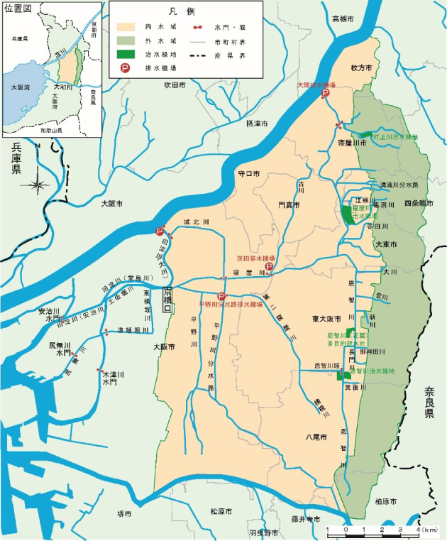
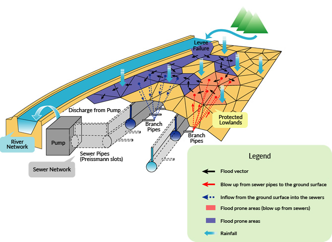
The Neyagawa basin is a low-lying area surrounded by the Yodo River in the north and Yamato River in the south, and the Ikoma Mountains in the east and Uemachi Plateau in the west. The vast basin covers an area of approximately 268 km2, including Osaka, Moriguchi, Hirakata and 9 other cities with a total population of approximately 2.75 million. The defining feature of the area is its low elevation. Fully three-quarters of the basin lies at elevations lower than the rivers, keeping rainwater from flowing naturally into the rivers. A system in place sees the rain collected in pump stations through the sewer lines, which is then forcibly pumped to drain into the surrounding rivers. However, the rainwater drains out in only one place: at the Kyobashi drain outlet. In addition, rapid urbanization starting in the late 1950s has reduced the water retention and storage functions that the rice and crop fields once provided, leaving the area vulnerable and subject to frequent flooding from inland water and other sources. Thus, Neyagawa basin residents have been fighting with flood damage for centuries.
The first real flood control started in 1954. Phase 1 for the Neyagawa Rehabilitation Plan was to dig out the present day Daini-Neyagawa River, Hirano River diversion aqueduct and other waterways. The Phase 2 plan came in 1976, with flood control basins, more diversion aqueducts and other features installed and riverbeds dredged. However, there are limitations to the ability of flood control measures with rivers alone. A flood in 1982 flooded the subfloors in about 34,000 homes, primarily in the Hirano River basin. The flood was caused by sewage pumps being shut off due to insufficient flow capacity in the river being discharged into. "This incident is what sparked the start of comprehensive flood controls, bringing the river administrators, sewer management, and cities in the basin together." Thus says Ken Saito, who has been involved in comprehensive flood control for the Neyagawa basin since discussions of the Master Plan for Neyagawa Basin River Improvements in 1988 all the way up to today. "At that time, there was just one engineer. Never in a million years did I expect to be at it for so long." - Ken Saito
Main NEWJEC work
-
- 1984-1987
- Comprehensive flood control measures (Investigation Committee for Comprehensive Flood Control Measures in the Neyagawa Basin)
-
- 1988-1989
- Discussions of Master Plan for Neyagawa Basin River Improvements
-
- 1990-1991
- Discussions of Master Plan for Neyagawa Basin Regulation Reservoir
-
- 1990-1993
- Discussions of Neyagawa Underground Diversion Channel Construction Engineering
-
- 1992-1995
- Onchigawa River Flood Control Green Zone Dispersion Plan (1995 Onchigawa River middle reach hydraulic model experiments)
-
- 1995
- Master Plan for Neyagawa Basin River Improvements established
-
- 1995
- Master Plan for Neyagawa Underground Diversion Channels (northern and southern) established
-
- 1994-1997
- Neyagawa Basin facilities arrangement planning, etc.
-
- 2000
- Discussions of changes to Master Plan for Neyagawa Underground Diversion Channels
-
- 2002
- Neyagawa Block River Development Plan for the Yodo River System
-
- 2003
- Neyagawa River designated as a flood advisory river (Neyagawa basin flood control plan commissioned as a class A river)
-
- 2005
- Neyagawa basin designated a special urban river basin
-
- 2003-2008
- Underground diversion channel level variation analyses for southern Neyagawa River
-
- 2003-2013
- Rules established for regulating pump operation
-
- 2014
- Deep underground utilization study (commissioned for basic design of underground diversion channels outside northern Neyagawa River and outside the Miyakojima regulation reservoir)
-
- 2015
- Problem solving when utilizing deep underground space (commissioned hydraulic model experiments for underground diversion channel in northern Neyagawa River and outside Tsurumi regulation reservoir)
-
- 2015
- Neyagawa Block River Development Plan for the Yodo River System (changes proposed)
-
- 2016
- Basic design work commissioned for underground diversion channel pumping station in southern Neyagawa River
Chapter 2
Handling a 30-meter drop height
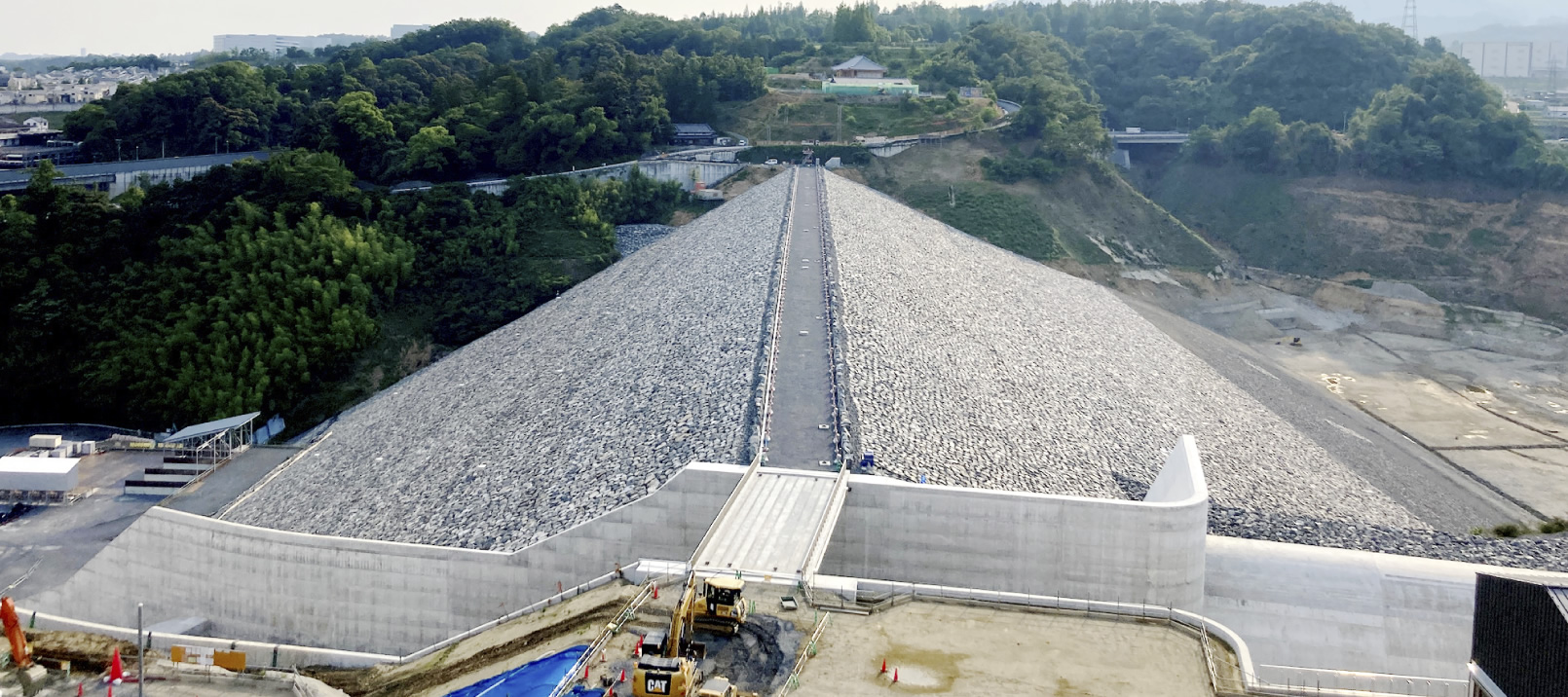
The Neyagawa basin was first in the country to begin comprehensive flood control measures. Among these measures, the two underground diversion channels in the north and south are the cornerstone of the plan.
"At the time, the most common ways to increase river flow rates were to widen the river or dig a new one, but all the urbanization made such work a real challenge. And so, we planned to establish underground diversion channels as new flood control facilities under roads and other areas, where there was no need for land acquisition." - Ken Saito
Massive underground diversion channels were planned-a 13-kilometer channel in the south and a 11-kilometer channel in the north (extended to 14 kilometers in the latest plan)-for which excavation is still underway today. At that time, there were few precedents of underground diversion channels and many problems in the planning. One such problem was energy dissipation of discharge from branching points.
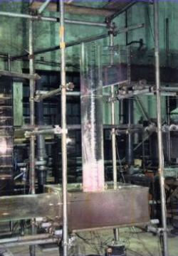
"For example, the drop from the Furukawa intake shaft in the northern underground diversion channel was about 30 meters. Letting the water fall from that height as-is would be noisy and damage the structure. To avoid this, we considered having the water flow through staggered steps or using a drop shaft, in which the water winds down the walls of the shaft in a vortex." - Ken Saito
We created models at the NEWJEC Uji Hydroscience Laboratory and ran some basic tests. As a result, we adopted a unique shape for the Furukawa intake shaft, adding a constrained section to a standard drop shaft to improve energy dissipation*. Original plans for the Johoku intake shaft were to adopt staggered steps, but this is being revised given the decision to install the tunnel section in deep underground space due to subsequent changes in the plan.
- The drop shaft with constrained section was awarded the JSCE Kansai Branch Engineering Award.
-
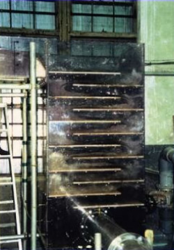
Staggered steps -
Drop shaft -
Scale reproduction testing (1/20-scale)
Chapter 3
Looking as natural as possible
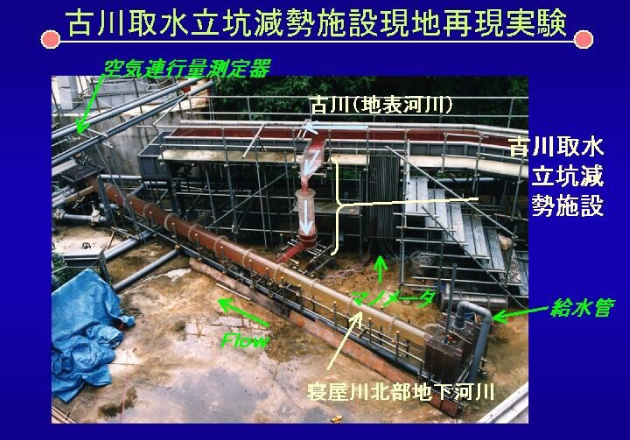
NEWJEC is running demonstration tests on several comprehensive flood control measures for the Neyagawa basin. One of the most memorable for Saito is the Onchigawa River middle reach hydraulic model experiments of 1995. Originally, plans were to establish a single flood control basin in the middle reach of the Onchigawa River to temporarily store flowing water in the event of a flood. However, due to troubles in land acquisition for the site, considerations shifted to whether the river flow could be dispersed and stored in three locations. In addition, the original plan was to set up floodgates to forcibly divert the flow. However, Saito suggested that simply adjusting the height of the overfall weir at the flood control basins would naturally divert the flow without having to set up floodgates. To prove it, a model was prepared to run demonstration tests.
"Onchigawa River flows near Mount Ikoma but since the Neyagawa basin is an area with almost no gradient, the location is a tidal section nonetheless. Also, the Neyagawa River has a flood control green zone, and the Onchigawa River has diversion facilities for diffluence into the Daini-Neyagawa River and a reverse flow section. There's more than one way to adjust the flow volume." - Ken Saito
In light of this, we built an elaborate system, installing a level gauge at the downstream end to measure flow rate, then analyzing the flow rate with a simulator, and determining the downstream water levels of the model for testing. Saito looks back on the time fondly: "We engineers were excited about the breakthrough, a hybrid of analog and digital. But the staff attending the tests paid it no attention. They certainly were impressed though at how flow was reversed as planned and cut at the flood control basins, all without floodgates." From the testing, it was decided to split the system into three flood control basins, eliminating the need for floodgates. Why get rid of the floodgate? "It just looks beautiful," says Saito. He wanted to leave it looking as natural as possible. Here lie the aesthetics of an engineer working to achieve technology in harmony with nature and people.
Chapter 4
Osaka Prefecture and 11 of its municipalities combine to prepare for the unexpected
Comprehensive flood control doesn't end when the facilities are installed. If rainfall exceeds the installation standards, disaster prevention and mitigation measures must be in place, such as instructions for resident evacuation or on how to operate the facilities to reduce flood damage. This area was primarily entrusted to Naoya Masuda. One of the most difficult things was formulating rules for regulating sewage pump operation.
"To prevent water ingress damage in the Neyagawa basin, rainwater normally flows through the sewers to a basin, from where it is pumped up to discharge into the river. However, if the pump keeps pumping at elevated river levels in heavy rain, it runs the risk that the river will overflow and result in a levee failure. Drainage with the sewage pumps must be restricted in heavy rain to avoid this, but this introduces another problem: in areas with pumps running at limited capacity, water can flood the ground and cause water ingress damage." - Naoya Masuda
The pumps can't be indiscriminately restricted; carefully set standards are needed for which pumps are to be restricted, and at what water level. Also, even if restricting a pump in City B to lower water levels will help City A when in danger of having a levee failure, explaining this to the residents of City B is no simple task. Also, it would be unfair if City C is always the one asked to restrict its pump.
Rules were devised to be followed by all the cities concerned, appealing to people's hearts more than their rational minds. Discussions started in 2003 and completed in 2013.
Says Masuda, "It took time, but the whole time was spent with repeated dialogues between the Osaka Prefectural river administrators and sewer administrators and the sewer administrators of the 11 cities. Each time, I was happy to see that the committee, comprised of its different stakeholders, congealed into a monolith." As we all know, it is the people who have the power to make a city disaster-resilient.
Chapter 5
Water flow analysis elucidates a project plan
In 2010, twenty years after the Neyagawa basin comprehensive flood controls were announced, the committee began discussing how to update its river improvement plans for the next thirty years. "Twenty years ago the economy was booming, but now we're in recession with budgets shrinking. We needed to prioritize the various possible flood control measures and propose cost-effective measures to control flooding more efficiently." - Ken Saito
How should the complex flow of water in urban areas be analyzed in order to judge the effectiveness of flood control measures quantitatively? This was the task taken on by NEWJEC's River Engineering Group. Through continuous improvements, the Neyagawa basin inundation analysis model inherited by the team is extremely complex, combining the rainfall, riverbeds, flood plains, and sewer flow levels. Using the model, analyzing the Neyagawa basin inundation analysis results was a tall task even for the highly experienced River Engineering Group. Evaluating the results was more difficult than any simulation they had ever seen before.
The basin has 30 rivers of varying sizes, and to top it all off, it is interlaced with a complex sewer network. These impact each other in complex ways, which can have unexpected effects. For example, if measures are taken to eliminate water ingress at point A, if this point is at a lower elevation, water may still flow in from another point through the ground surface or sewers. This makes it difficult to judge what effect the measures had.
Every day, from the opening chimes of the day to their bitter end, the team would run simulations and futilely tally up result after result. Finally, after six months of analysis, there was a breakthrough. An idea formed to separate out the flooding inside and outside the levees. As flooding outside the levees causes damage on a larger scale, measures would first be taken to prevent this flooding before moving onto flooding inside the levees. Following that story thread, the measures and evaluations started to click. After all, simulations don't always result in a clean answer. The question is how to analyze the results and piece the story into a project plan. This is the true test of engineering skill.
In March 2015, Osaka Prefecture published the Neyagawa Block River Development Plan for the Yodo River System. The story suggested by the River Engineering Group had set the river improvements for the next 30 years in motion.
Chapter 6
Steadily progressing toward flood resilience
Saito looks back over the past 40-plus years: "Comprehensive flood controls started for the Neyagawa basin in 1990. Year after year, facilities were added, and sewage pump operation was regulated. In recent years, no flood has inundated the entire river basin. Of course, plans will need to be partially revised as the underground diversion channels are opened and issues will need to be addressed, but the basin is much safer." The Neyagawa basin is steadily emerging from its continuing struggle with flooding to become a flood-resilient area.